A lot has happened since leaving Julian! Upon resuming on the trail, we encountered our first “trail magic.” At the road crossing we were dropped of at, at local trail angel from San Diego named “Bad Santa” pulled up with his truck drill of fruit, Gatorade, beer, and rice crispies – a perfect start to the next leg of the trail. Once we started hiking, we enjoyed hiking through beautiful blooming cactus gardens.


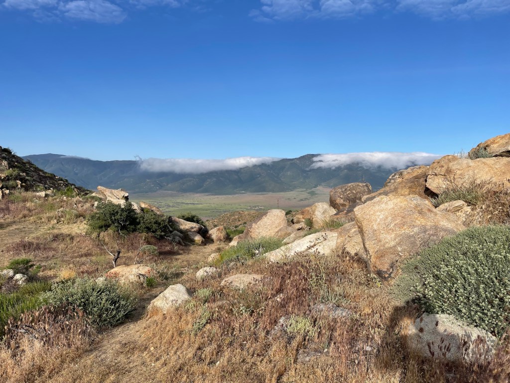
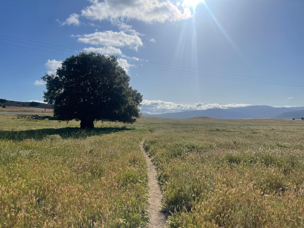
Our next stop was Warner Springs, a tiny community where we picked up a resupply box at the post office. On the way we passed through beautiful rolling meadows where cows were grazing, one of the most beautiful stretches of trail yet.

Exiting Warner springs, we continued hiking through hills filled with chaparral. Climbing higher into the hills, we found out rain was in the forecast. Luckily, we were close to “Mike’s Place,” one of the more infamous stops on trail. Essentially, the aforementioned Mike owns a plot of land (probably more appropriately called a junk yard) where he allows hikers to set up camp and refill from his water tanks. Here temperatures dipped close to freezing for the first time with strong wind gusts and rain. After waiting out the rain with some fellow hikers, we began our descent down the hill.


Next on the docket was Paradise Valley Cafe. From here, my brother-in-law Mitch was planning to pick my sister and me up and drive us to Idyllwild to take a day off. Our friends Travis and Marissa met us there, and we were able to recover from our fist 100+ miles on trail.
Up until now, the trail didn’t seem that tough. That changed once we returned to trail after Idyllwild.
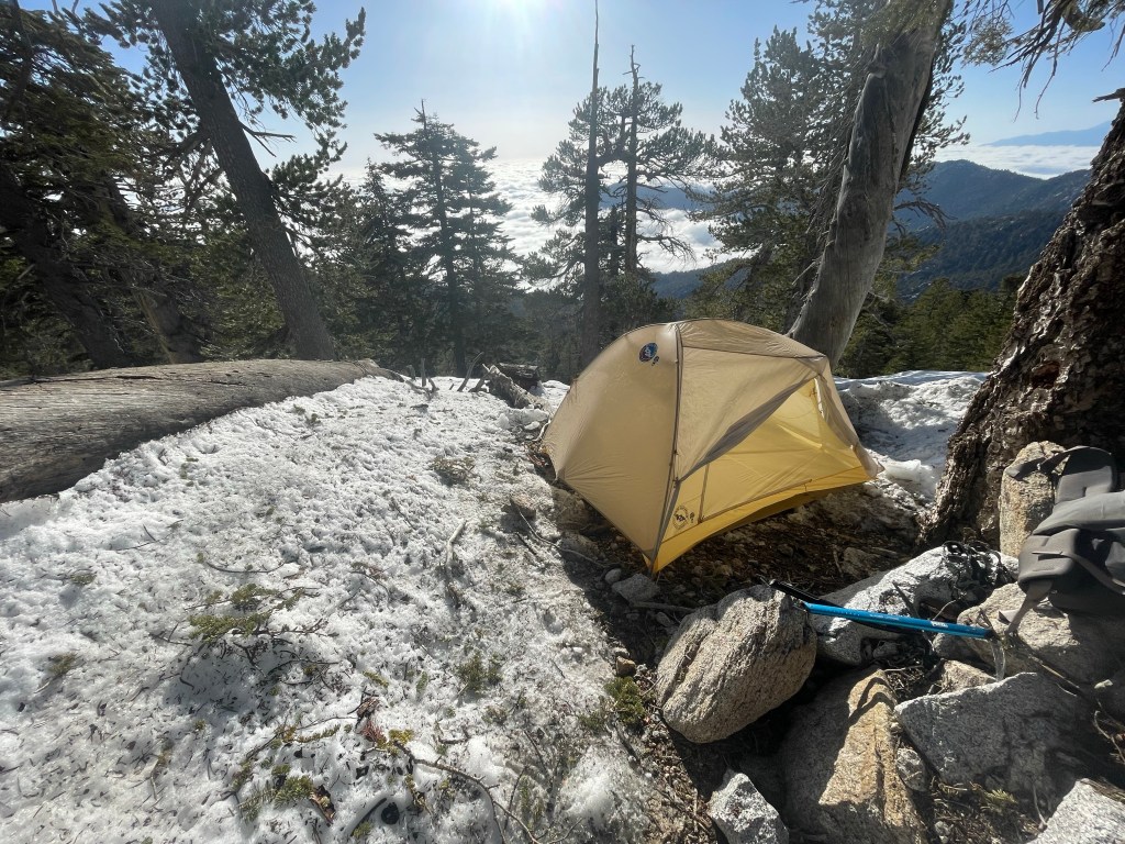
Our first challenge was a day with a 4500 foot climb, which at the time we thought was tough. That night we camped on the top of a ridge looking out over the desert with clouds rolling over us.
At this point, we had gotten to an elevation we’re snow patches started popping up. It wasn’t bad until we got closer to San Jacinto. Our first encounter with snow was a fairy tame walk through snow fields. Not difficult or dangerous, but just slow moving. Unfortunately, at one point I slipped and had a minor fall which caused one of my hiking poles to snap in half, making snow travel on the rest of this stretch more difficult. That night we found a dry spot to camp, but we ended up getting snowed on that night.

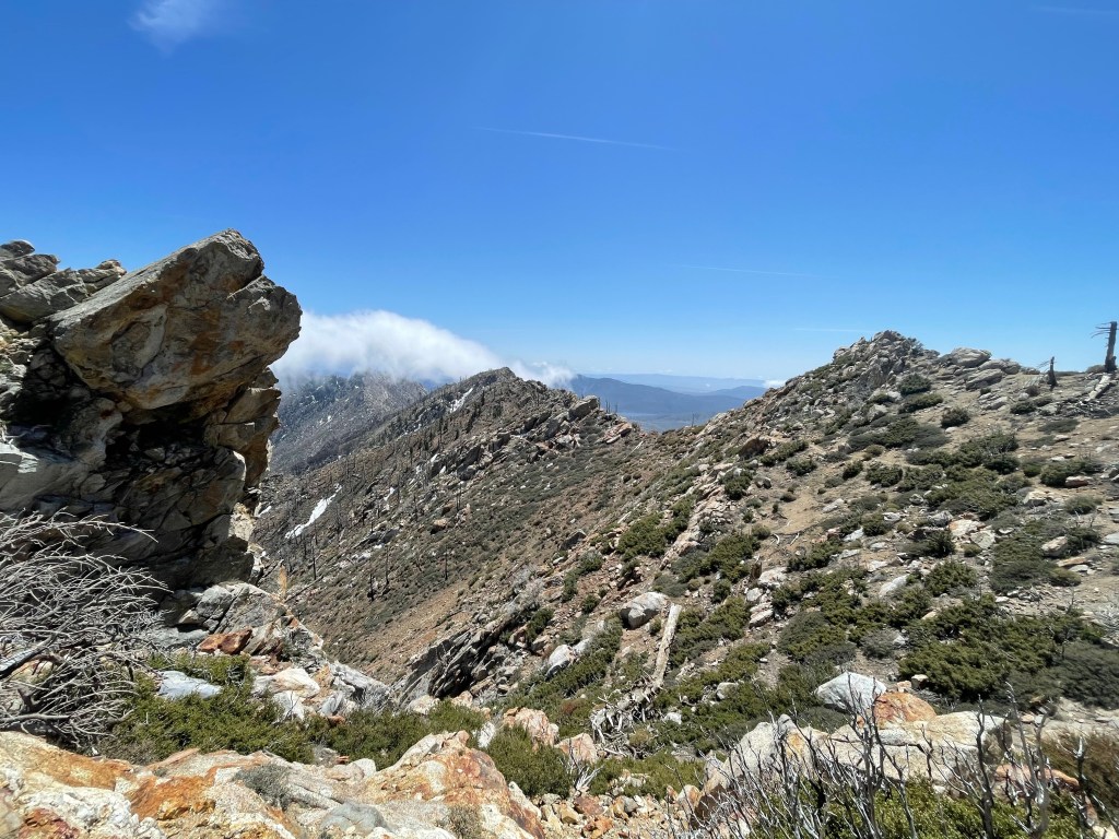
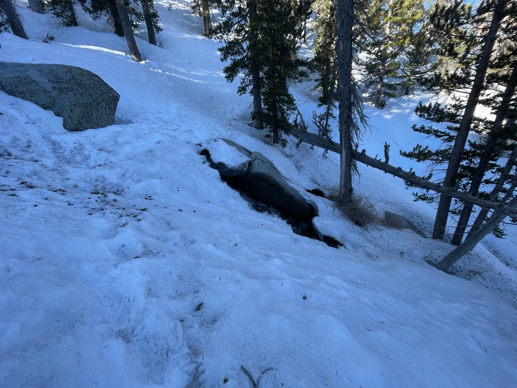
The next day was full of snow. For most of the day the snow was just an annoyance as we hiked around Mount San Jacinto. At the end of the day, we began an infamous section known as Fuller Ridge. This stretch of trail traverses a ridge line pretty much covered in snow, at time pretty exposed with steep slopes. As we hit this at the end of the day, the snow had become slushy making it much easier to slip even with the appropriate gear (i.e. micro spikes and ice axes). Due to this condition, we made the call to set up camp immediately on the slope and resume once the snow was crunchy again in the morning. Crunchy, frozen snow is much faster and safer to traverse than slush. Unfortunate, this meant we had to share a tent on an extremely sloped, rocky terrain, resulting in a bad night’s sleep. When hitting the trail again the next morning, snow travel was much easier until the afternoon once we hit slushy snow again.


Once we started descending and exited the snow, we headed towards Cabazon where our friend Travis met us with a resupply box. Most importantly, we were able to take a detour to In-N-Out while we were there.


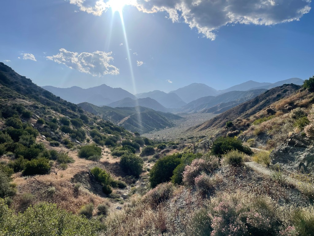
Exiting Cabazon was tough. Since we had descended to lower elevation, we hit 100 degree temperatures while having to do significant climbs. As a result, we took an extended siesta one day at Whitewater River – it felt like a beach day and it was glorious. This was also our first significant water crossing where we had to exercise caution.
Next was one of our toughest days yet – a 5400 foot climb up to higher elevation. I’m pretty sure this is the most elevation gain I’ve done in a single day, but thankfully this brought us to cooler temperatures. And surprisingly, we began to see way more hikers than any other parts on trail. From here we began our rolling descent into Big Bear.
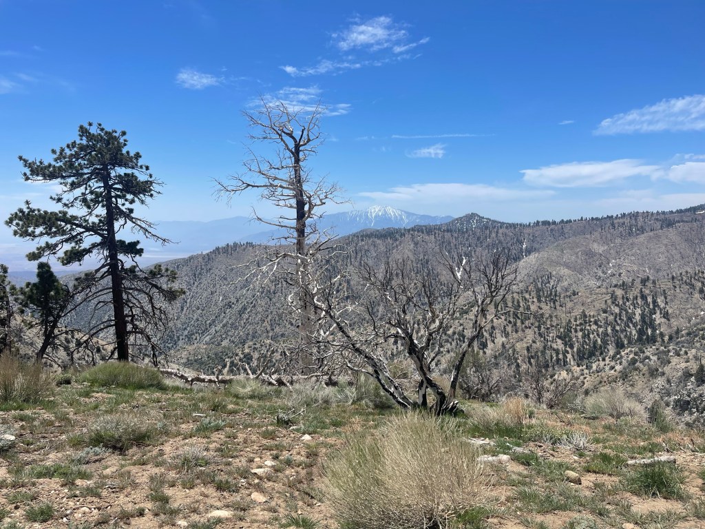
As I write this we are getting ready to hit the trail again after taking a much needed day off in Big Bear Lake. Next up is Wrightwood. From what we hear this next section should be somewhat tame, but after that we’ll be hitting more snowy conditions in the San Gabriels.

Leave a reply to Mormor Cancel reply